Organizational Structure
The Red Rock Indian Band is located at the cross roads of highway 11 and 17 East of the Nipigon River bridge in Northwestern Ontario, Canada. The traditional territory of the Ojibway First Nation includes the entire Lake Superior/Lake Nipigon watershed and they are signatories to the 1850 Robinson Superior Treaty. The community actively uses two parcels of land designated as Indian Reserves by the Departments of Aboriginal Affairs and Northern Development Canada (AANDC), reserve 53 located at Parmachene north up the Nipigon River and reserve 53A located at Lake Helen where the community is presently situated. The total area covered by the two reserves is approximately 950 acres (3.8km2).
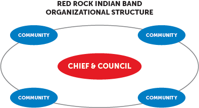
The First Nation, led by Chief Allan Odawa Jr. and band council, is a member of the Union of Ontario Indians. Red Rock Band Chief and Council are elected to administer the day to day operation of the First Nation. Band elections are governed under band custom and the term of office is 4 years. The next general election is scheduled for September 2027.
As of January 2024, the band population consists of 2320 members located across Canada, North America, and the world.
10 Canadian provinces presently have band members residing within them including Ontario, British Columbia, Alberta, Saskatchewan, Quebec, Yukon, Nova Scotia, New Brunswick, Manitoba, and the North West Territories. Red Rock Band members also live in other parts of the world including Norway, New Zealand, and Australia.
A total of 340 people live on Lake Helen Reserve whereas 285 are band members. Lake Helen Reserve is located 120km east of the city of Thunder Bay and 2km northeast of the town of Nipigon on the shores of Lake Helen along highway 11. 15% of the total band registered population live on reserve. There are 110 houses on Lake Helen Reserve. 2035 band members live off reserve.